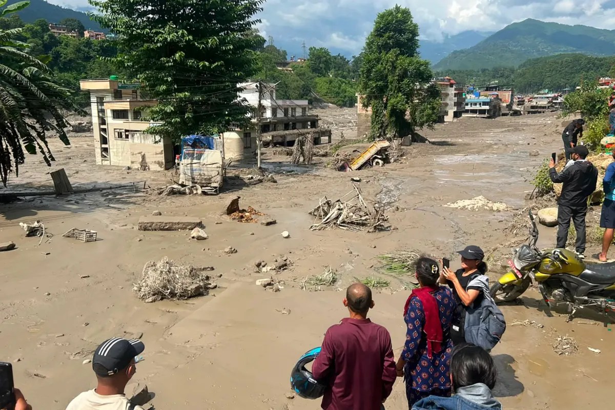
High-altitude cryospheric systems in the Hindu Kush Himalayan region are undergoing rapid thermal degradation, shifting baseline stability metrics across fragile mountain watersheds. Recent empirical assessments by the International Centre for Integrated Mountain Development identify forty-two glacial water bodies in Nepal as high-risk nodes primed for structural failure. These impoundments, sitting behind unconsolidated debris dams, represent localized accumulation points of hydrostatic pressure. Understanding the threat profile requires deconstructing the physical mechanics of moraine-dam degradation, the velocity of mass-wasting events, and the structural vulnerabilities embedded within trans-boundary river basins.
The Mechanics of Moraine Dam Failure
Glacial lakes do not form behind engineered concrete walls. They are contained by terminal and lateral moraines—heterogeneous aggregations of boulders, gravel, sand, and ice core material deposited by retreating glaciers. These natural barriers lack cohesive strength.
Two primary mechanisms drive structural collapse:
- Hydrostatic Overpressure: As atmospheric warming accelerates ablation rates, meltwater accumulates faster than natural drainage or evaporation can dissipate it. The rising water level increases lateral pressure against the internal face of the moraine wall, exceeding the shear strength of unconsolidated sediment.
- Dynamic Displacement Triggers: Catastrophic failure is frequently induced by external kinetic shocks rather than slow seepage alone. Ice avalanches plunging from adjacent peaks or seismically induced ground acceleration displace a massive volume of water instantly. This generates a high-energy displacement wave that overtops the moraine crest, rapidly eroding the loose material through downward cutting.
Once breaching begins, the process accelerates exponentially. The outflow acts as an erosive agent, carving through the moraine wall and releasing millions of cubic meters of water, mud, and debris within hours. This phenomenon, classified as a Glacial Lake Outburst Flood, transforms localized high-altitude water storage into a high-velocity destructive surge downstream.
Hydrodynamic Propagation and Downstream Vulnerabilities
The destructive capacity of an outburst flood is a function of valley geometry, channel gradient, and sediment entrainment. As the initial water volume breaches the moraine, it picks up riparian sediment, boulders, and vegetation, doubling or tripling its initial mass. This transforms a clear-water flood into a hyper-concentrated debris flow.
Valleys featuring narrow gorges restrict the lateral dispersion of the flood wave, amplifying peak discharge height and flow velocity. Infrastructure located within these alluvial fans and narrow floodplains faces immediate destruction. Hydropower installations, bridge abutments, and rural settlements situated along primary river arteries—such as the Koshi basin river networks—operate within high-exposure zones.
The kinetic energy of the flow diminishes only when the valley floor widens significantly or gradient angles flatten, causing widespread deposition of coarse sediment across arable land. This process destroys agricultural capacity, alters river morphology permanently, and severs linear infrastructure corridors linking remote mountain communities to regional trade hubs.
Transboundary Risk Distribution and Regional Coordination
Cryospheric hazards do not respect geopolitical boundaries. A significant percentage of critical glacial impoundments affecting lower riparian regions originate across national borders in high-altitude zones shared with the Tibetan Plateau. Water accumulation, ice recession, and meteorological shifts operate on regional climatic drivers that require synchronized monitoring frameworks.
Effective risk mitigation necessitates shifting from reactive disaster response to predictive asset management. Standardizing high-altitude data collection involves three operational imperatives:
- Continuous Telemetric Monitoring: Deploying autonomous radar level sensors, water discharge gauges, and weather stations at high-risk lake sites to capture real-time hydrological anomalies.
- Downstream Early Warning Architecture: Establishing automated acoustic and digital alert systems linked directly to vulnerable valley communities, securing critical evacuation latency before a flood wave arrives.
- Engineering Intervention Protocols: Implementing controlled siphoning, artificial drainage channels, and spillway construction to lower baseline water volumes in structurally compromised lakes.
Integrating these technical safeguards into national land-use policies and multi-lateral infrastructure planning dictates whether regional development can outpace accelerated cryospheric destabilization. Prioritize capital allocation toward automated sensor deployment and community-level evacuation drills along high-gradient river corridors before the next seasonal thaw cycle peaks.