The World Meteorological Organization has dropped a statistical hammer, revealing an 80 percent probability that a new El Nino climate pattern will establish itself between June and August. This means the brief window of neutral conditions the planet enjoyed following the recent weakening of La Nina is officially slammed shut. By November, the probability of El Nino dominance rises to a staggering 90 percent, with advanced forecasting models indicating the event will be moderate to severe.
This is not a routine cyclical shift. The true crisis lies in the unprecedented thermal baseline of the modern ocean. For decades, the El Nino Southern Oscillation operated within predictable parameters, trading cool phases for warm ones over two-to-seven-year cycles. Today, this engine is firing inside an atmosphere already supercharged by greenhouse gas emissions. The planetary system is running a severe fever. Layering an intense Pacific warming event over this baseline guarantees a cascade of compounding weather extremes that will expose systemic vulnerabilities in global food infrastructure, water grids, and regional economies.
The Mechanics of a Supercharged Baseline
To understand why this development is uniquely dangerous, one must look below the surface of standard meteorological reporting. The conventional narrative treats El Nino as an isolated thermostatic switch. Warm water accumulates in the central and eastern equatorial Pacific, the trade winds weaken, and weather patterns shift. This view misses the structural reality of the modern climate.
During a typical El Nino, the ocean releases immense reserves of stored heat into the atmosphere. The 2023-2024 El Nino phase drove global temperatures to historic highs, positioning 2024 as the warmest year on record at approximately 1.55 degrees Celsius above the pre-industrial average. The ocean never truly recovered from that discharge. Subsurface sea temperatures in the tropical Pacific have remained anomalously high, even during the brief La Nina iterations that followed.
The upcoming event represents a direct re-ignition of this thermal engine without an adequate cooling-off period. When the atmosphere and the ocean couple over the summer months, the energy exchange will be amplified by the sheer volume of water that is already near record temperatures. Meteorologists trace this phenomenon through the Southern Oscillation Index, which measures the atmospheric pressure differences between Tahiti and Darwin. The index is tumbling. The atmosphere is rapidly locking into alignment with the warming waters, ensuring that the physical impacts will manifest with greater speed and geographic reach than historic precedents would suggest.
The First Line of Agricultural Failure
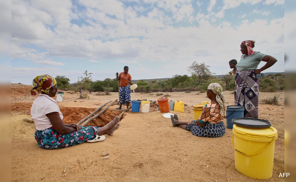
The immediate geopolitical threat will materialize across South Asia and the Greater Horn of Africa, where the human cost of a disrupted monsoon season is measured in systemic food insecurity. The South Asian summer monsoon, which dictates agricultural output for over a billion people, is historically vulnerable to Pacific warming.
As El Nino shifts the Walker Circulation eastward, rising air and heavy precipitation migrate away from the western Pacific. This leaves India, Indonesia, and parts of Southeast Asia under zones of sinking, dry air. The timing could not be worse for regional infrastructure.
- Reservoir Depletion: India’s 166 major reservoirs are currently holding roughly 25 percent of their total capacity. Peninsular India faces severe water deficits before the El Nino impacts even fully materialize.
- Crop Failure: Suppressed monsoon rainfall during the critical June-to-September window directly threatens staple crops like rice, sugarcane, and oilseeds, driving immediate food price inflation.
- Hydroelectric Demands: Dropping water levels will simultaneously curtail hydropower generation just as record heatwaves spike the regional demand for electrical cooling.
A parallel dynamic will unfold across the northern Greater Horn of Africa. Countries like Sudan, South Sudan, and western Kenya face a severe reduction in seasonal rainfall. Conversely, eastern Africa and parts of southern South America are projected to experience torrential downpours and sudden flash flooding. This geographic polarity highlights the fundamental instability of the coming months. One hemisphere faces the rapid onset of agricultural drought while the other struggles with infrastructure-destroying deluges.
The Illusion of the Atlantic Hurricane Reprieve
A common point of reassurance in standard meteorological forecasts is that El Nino suppresses Atlantic hurricane activity. This occurs because the altered wind patterns create high vertical wind shear across the Caribbean and Atlantic basins, effectively ripping apart tropical storms before they can organize into major hurricanes.
This comforting historical metric ignores the realities of contemporary oceanography. Atlantic sea surface temperatures are hovering at levels that defy historical baselines. While vertical wind shear will act as a stabilizing force, the sheer thermal energy available in the upper layers of the ocean acts as a massive accelerator.
The resulting conflict between high wind shear and extreme ocean heat creates a highly unpredictable environment. Instead of a quiet hurricane season, the structural conditions point toward a lower overall volume of named storms but a significantly elevated risk of rapid intensification for any storm that manages to bypass the wind shear. A tropical depression can mutate into a Category 4 system in less than 24 hours if it passes over an isolated pocket of superheated water, rendering traditional evacuation timelines obsolete.
The Timeline for Record Shattering
The true thermal bill for this upcoming El Nino will not come due immediately. The atmosphere lags behind the ocean. While the northern hemisphere summer will experience immediate localized heat domes and severe regional droughts, the systemic global temperature spike will crest much later.
Historical analysis reveals that the second year of an El Nino event bears the brunt of the planetary temperature increase. The initial Pacific warming will build through the winter of 2026. This trajectory positions 2027 as the primary candidate to shatter the global temperature records set in 2024. WMO modeling indicates an 86 percent probability that a single year before 2030 will surpass 2024's baseline, and a 91 percent probability that the planet will temporarily breach the 1.5 degrees Celsius threshold established under the Paris Climate Agreement during this block of time.
This temporary breach does not mean the Paris Agreement has failed entirely, as that metric relies on a sustained 20-year average. It does, however, mean that the buffer zone has evaporated. The system is operating at its absolute physical limit, and the arrival of an unmitigated El Nino ensures that volatile, compounding weather hazards will cross international borders with unprecedented velocity.