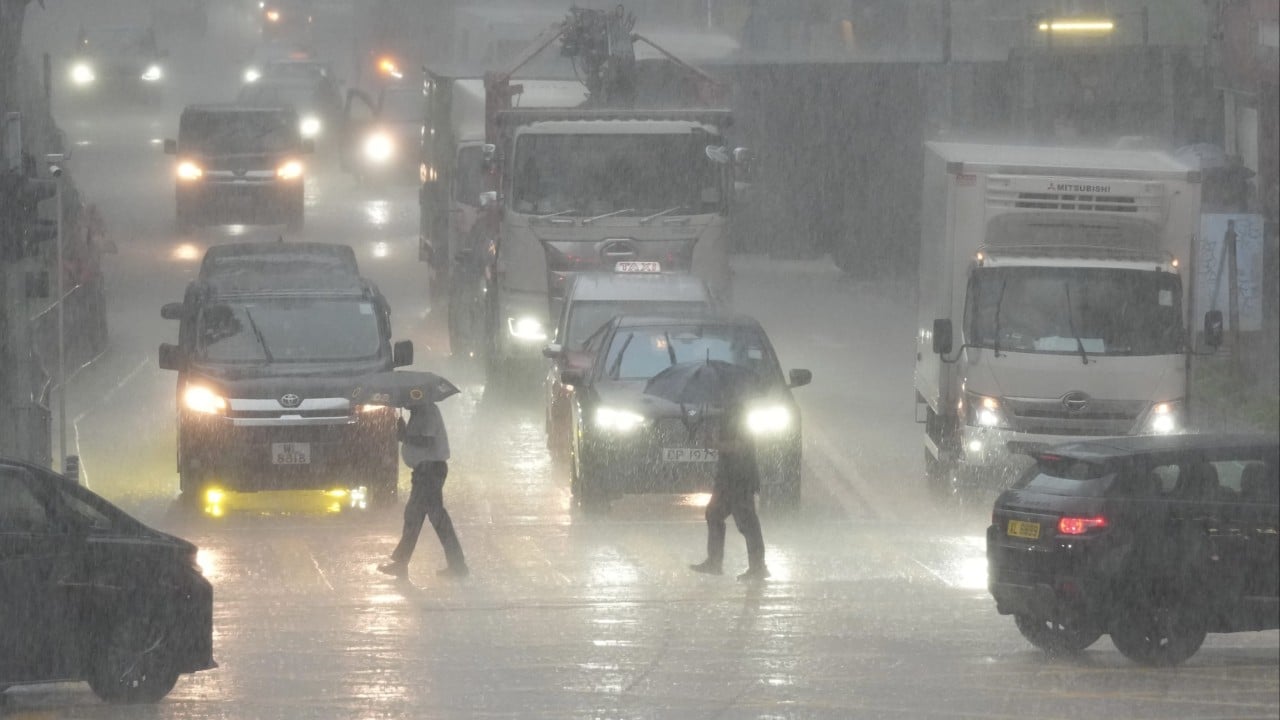
The sky turns the color of a bruised plum. Within minutes, drainage systems groan, streets morph into raging rivers, and millions of commuters find themselves stranded across the territory. Hong Kong just slapped a red rainstorm warning on the city, and if you have lived here for more than five minutes, you know exactly what that chaos feels like.
Thundery showers are locking themselves in over the weekend. They refuse to budge. The Hong Kong Observatory keeps updating their radar loops, showing wave after wave of moisture feeding directly into the Pearl River Delta from the South China Sea.
People panic. Commuters scramble. Parents wonder if Monday morning will bring school suspensions. Let us break down what is actually happening in the atmosphere, why these weekend storms hit so hard, and how you can survive the deluge without losing your mind or your dry shoes.
Understanding the Red Rainstorm Alert
What triggers the red alert? Simple math and heavy water. The Hong Kong Observatory issues a red rainstorm warning when heavy rain has fallen or is expected to fall generally over Hong Kong, exceeding 50 millimeters in an hour.
Traffic gets paralyzed. Low-lying areas flood instantly. Mountainous terrain triggers landslide risks that keep rescue teams on high alert.
Most people misread the warning system. They think amber, red, and black are just intensity gauges. They are actually operational thresholds. A red warning means significant disruption is guaranteed. Public transport operators adjust schedules. Outdoor workers seek shelter. Businesses in flood-prone districts like Sheung Wan or Happy Valley start rolling out heavy aluminum flood barriers.
The weekend timing makes it worse. Tourists trapped in Tsim Sha Tsui outdoor malls stare blankly at cascading stairwells. Local families cancel dim sum plans. The humidity climbs to 100 percent, turning apartments into tropical greenhouses.
The Weekend Weather Trap
Why do these downpours love the weekend? They do not. It is pure confirmation bias mixed with seasonal climatology.
We are deep into the monsoon transition period. Warm, moisture-laden maritime air crashes into residual cooler air masses lingering from the north. The terrain of Hong Kong acts like a vertical blender. Peaks like Tai Mo Shan and Victoria Peak force moist air upward rapidly, cooling it, condensing it, and squeezing out torrential rain like a wet sponge.
What the Radar Is Actually Showing Right Now
- Persistent convective bands forming offshore.
- Slow-moving storm cells dumping localized buckets of water.
- High wind shear capable of turning standard umbrellas inside out in a fraction of a second.
If you are planning a hike on Dragon's Back or a lazy afternoon ferry ride to Lamma Island, cancel it. Seriously. Trails turn into slick mudslides. Streams swell from ankle-deep trickles to raging torrents in under ten minutes. Mountain rescue teams hate pulling stranded hikers off saturated hillsides because the visibility drops to zero during the heaviest squalls.
Practical Survival Steps for the Deluge
Stop waiting until the water laps at your doorstep to take action. Living in a subtropical vertical city requires a specific survival toolkit.
First, check your building’s drainage points. If you live in an older walk-up in Kowloon or Sai Ying Pun, clearing leaves and debris off the balcony drain right now will save your living room from indoor swimming pools.
Second, stock up on essentials smartly. You do not need to clear out supermarket shelves of instant noodles like it is the apocalypse. Just grab enough fresh water, easy-to-prep food, and phone charging banks to ride out a 24-hour power dip or transit blackout.
Third, monitor official channels without refreshing social media every three seconds. Stick to the Hong Kong Observatory app or official government bulletins. Misinformation spreads fast on WhatsApp groups during a red rainstorm, with people sharing old videos from past typhoons to create panic.
How to Handle Transit Chaos
When the red warning drops, the MTR usually keeps running underground lines, but open-air sections face speed restrictions or sudden suspensions if lightning strikes sensitive infrastructure.
Buses get diverted. Taxis vanish. If you see a line of fifty people outside a cross-harbour bus station during a torrential downpour, do not join it. Walk into the nearest shopping mall connected to the MTR network, grab a coffee, and wait out the peak rainfall rate. These intense convective cells usually dump their heaviest loads over a two-to-three-hour window before easing into steadier, manageable rain.
Keep your Octopus card topped up. Keep your phone dry in a ziplock bag if you have to brave the elements. Wear sandals or waterproof footwear instead of nice leather shoes that will disintegrate the moment you step into a hidden knee-deep puddle on Des Voeux Road.
Stay inside. Watch the rain hammer the glass. It will pass by Monday morning, leaving behind clean air, blue skies, and a city ready to start all over again.

/GettyImages-157526585-93425538070d4422ad42d22af28c0758.jpg)