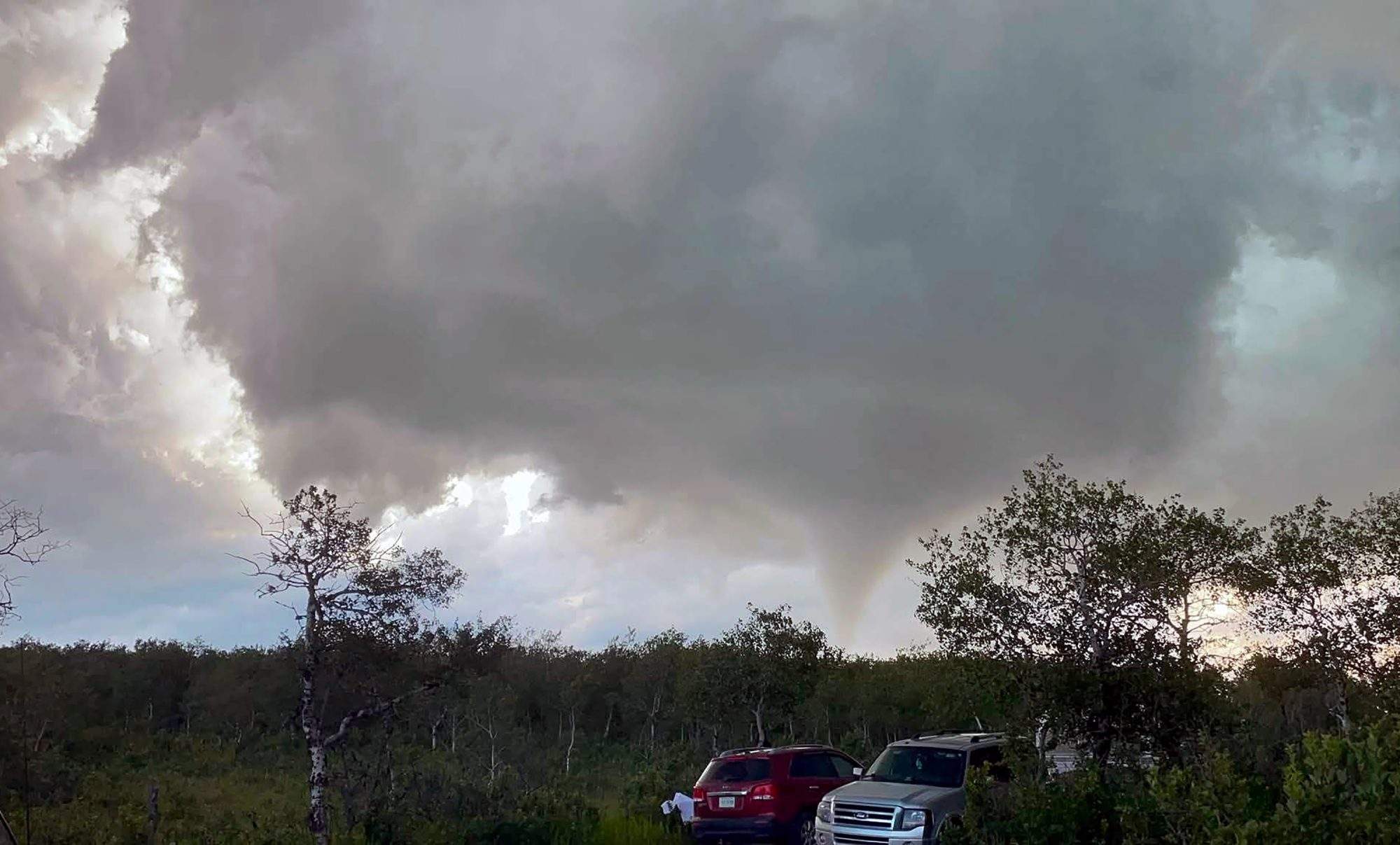
The media is sounding the alarm over a supposed atmospheric apocalypse in Western Canada. Headlines point to a record-tying ten tornadoes striking Saskatchewan in a single day, paired with a fifty percent year-over-year spike in Alberta twisters. The convenient culprit slapped onto every broadcast is the current humid heat wave. The narrative is tidy, terrifying, and completely flawed.
You are being sold an illusion of data. The Prairies are not suddenly turning into an unlivable war zone of spinning vortexes. What we are witnessing is not a dramatic shift in global weather systems, but a revolution in how we look at the sky.
The mainstream panic ignores a basic reality of atmospheric science and a massive shift in observation technology. The surge in numbers is a tracking surge, not a physical one.
The High Resolution Illusion of Severe Weather
For decades, if a tornado dropped in an empty canola field sixty kilometers outside of Lloydminster and no one was around to film it, the event simply never existed in the official record. Canada is a massive country with a tiny population footprint clustered along the southern border. The historical climate baseline for Canadian tornadoes has always been deeply underreported.
Enter the Northern Tornadoes Project out of Western University. Founded in 2017, this initiative set out to systematically find every single twister that touches down on Canadian soil. They do not just wait for a local farmer to call in a damaged roof. They actively hunt for clues using high-resolution satellite imagery, dedicated drone fleets, and advanced damage-pattern analysis.
When the Northern Tornadoes Project began its full campaign, the national tornado count instantly spiked. In their early seasons alone, they uncovered dozens of tornadoes that would have gone completely unnoticed in the past, effectively raising the verified count by over seventy percent in certain regions.
What the public reads as a dangerous new trend is actually scientists finally doing a thorough job of auditing the wild. The historical data we are comparing today's numbers against is fundamentally broken. You cannot compare a 2026 data map built on satellite surveillance and smartphone-wielding storm chasers with a 1996 data map built on landline phone calls and small-town newspapers.
Why Intense Heat Actually Smothers Twisters
The second fatal flaw in the mainstream narrative is the lazy link between extreme heat waves and increased tornado activity. Mainstream reports imply that hotter air automatically translates to more spinning wreckage. The actual physics of the atmosphere tells a completely opposite story.
To get a tornado, you need instability, moisture, wind shear, and a trigger. A massive high-pressure ridge—the classic heat dome currently cooking Manitoba and Saskatchewan—creates what meteorologists call a cap. This is a layer of warm air aloft that acts as a physical lid on the atmosphere.
This convective inhibition prevents air from rising. If the air cannot rise, storms cannot form.
When a heat wave is total, the sky stays completely clear. The air is stifling, humid, and entirely stagnant. The severe weather only breaks out on the extreme periphery of these heat domes, or when a massive cold front slams into the ridge and violently shatters the cap.
Blaming the heat wave itself for producing more tornadoes misses the mechanical truth. The heat wave is the atmospheric dampener. The tornadoes happen despite the heat wave, not because of it, occurring only when the oppressive system begins to fracture.
The Silent History of Empty Field Twisters
Look closely at the recent reports. Ten tornadoes in Saskatchewan. A touchdown in the Tulliby Lake area. Damage to property, yes, but zero casualties.
This lack of casualties highlights the geographic reality. The vast majority of these recorded events are weak, short-lived twisters hitting spaces where the population density is near zero. In the past, these brief touchdowns left minor tracks in deep bush or open plains, erased by the next rainfall long before an official surveyor could ever take note.
The Western University data shows that historically, around eighty-eight percent of all documented Canadian tornadoes fall into the weak categories of F/EF0 or F/EF1. They are minor events. The reason we see more of them now is that our tools are sensitive enough to spot a path of bent grass in a remote northern forest.
We have traded ignorance for observation and mistaken it for an escalating crisis.
Stop Panicking About the Numbers
The dangerous part of this media misdirection is that it forces the public to focus on the wrong threat. By obsessing over the raw count of tornadoes, we overlook the actual infrastructural challenges posed by severe convective storms, like straight-line downbursts, massive hail, and localized flash flooding. These less cinematic hazards routinely cause far more economic damage across the Prairies than a brief, remote twister ever will.
If you want to understand the modern weather environment, look at the tools of the researchers, not the sensationalism of the evening news. The sky is not falling. The cameras have just gotten much better at capturing the drop.