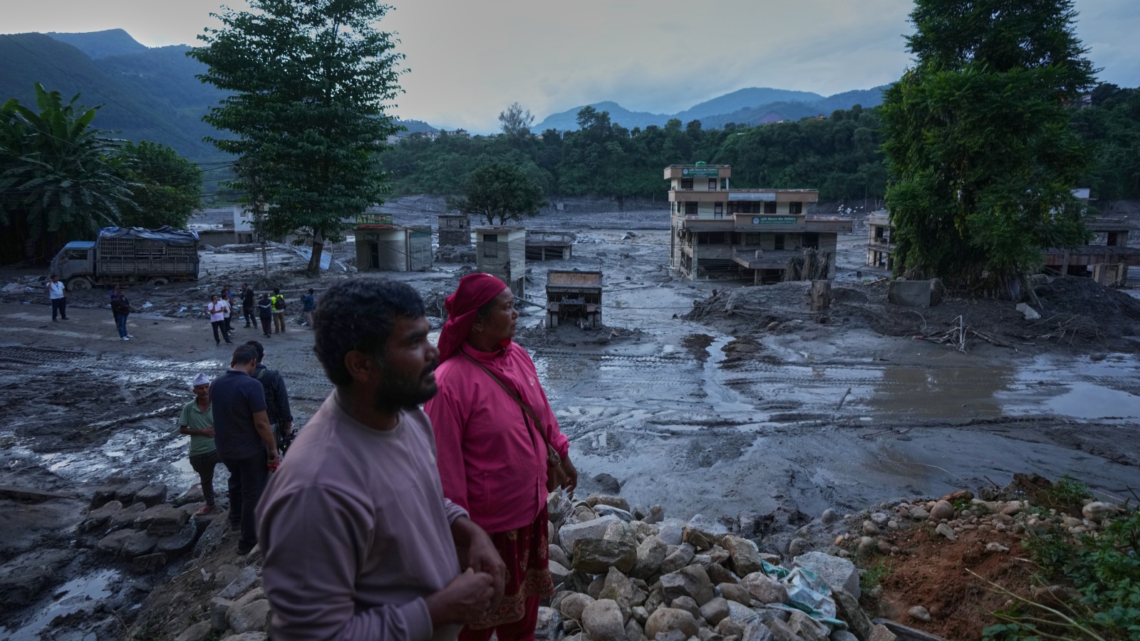
Disaster response models across the Himalayan corridor are structurally obsolete, built on the false premise that flash floods behave as seasonal river overflow events rather than high-velocity debris avalanches. When a glacial collapse along the Nepal-Tibet border triggered a massive surge of ice, rock, and mud down the Bhotekoshi and Trishuli river systems, the resulting inland tsunami exposed systemic vulnerabilities in cross-border early warning infrastructure. With the confirmed death toll surpassing 460 and over a thousand individuals remaining unaccounted for, municipal authorities and emergency management agencies are confronting a casualty multiplier effect driven by unmapped terrain instability and compounding secondary hazards.
The primary driver of this catastrophe was not standard meteorological rainfall, but a seismic-equivalent glacial collapse that registered initially on monitoring instruments as a magnitude earthquake. This mechanical failure sent millions of metric tons of solid mass downward into narrow mountain gorges, transforming valleys into high-pressure conduits of slurry. Traditional flood forecasting mechanisms rely on water-level gauges that measure volumetric discharge over hours. In contrast, a glacial debris flow acts as a solid-fluid composite moving at highway speeds, destroying gauging stations instantly upon impact and rendering predictive lead times mathematically zero for immediate downstream settlements like Timure and Syaphrubesi.
This event highlights three structural bottlenecks in high-altitude disaster management:
The first bottleneck is topological opacity. The convergence zones of Tibetan headwaters such as the Chhochen Khola and Purepu Tsangpo flow across geopolitical boundaries where real-time telemetry sharing remains constrained by bureaucratic friction. When a debris dam forms in remote gorges, downstream nations operate blind until the natural barrier breaches.
The second bottleneck is infrastructure load-rating. Hydropower projects, bridges, and highway corridors linking Kathmandu to Lhasa are engineered to withstand maximum historical water loads, not dynamic impact loads from multi-story walls of boulders and glacial ice. The destruction of structures like the Upper Trishuli-1 Hydropower Project demonstrates that structural engineering standards in the region must incorporate debris-impact dynamics rather than fluid-dynamic pressures alone.
The third bottleneck is demographic vulnerability concentration. Valley floors in the Himalayas serve as the sole economic corridors for trade, pilgrimage, and tourism. Towns are intentionally built on alluvial fans—geologically active zones that are, by definition, deposits of past catastrophic floods.
Compounding the initial destruction, secondary hazard formation currently presents an active operational threat. Chinese water resources ministries and the International Centre for Integrated Mountain Development have tracked the rapid accumulation of millions of cubic meters of water behind newly formed debris blockages. As inflow volumes continue to outpace natural seepage, these barrier lakes function as unmanaged high-head dams. The potential breach of these temporary reservoirs introduces the probability of a secondary cascading wave, forcing rescue operations to halt temporarily as emergency personnel evacuate high-risk flood paths.
Managing high-altitude systemic risk requires a transition from reactive body-recovery operations to predictive geotechnical engineering. Civil protection agencies must integrate satellite-based interferometric synthetic aperture radar to monitor slope stability and ice-mass thinning in real time across inaccessible upper basins. Cross-border hydrological data agreements must transition from delayed diplomatic reporting to automated telemetry sharing. Until infrastructure vulnerability assessments account for solid-fluid debris dynamics, population centers along Himalayan river corridors will remain exposed to high-consequence, low-latency catastrophic failures.


