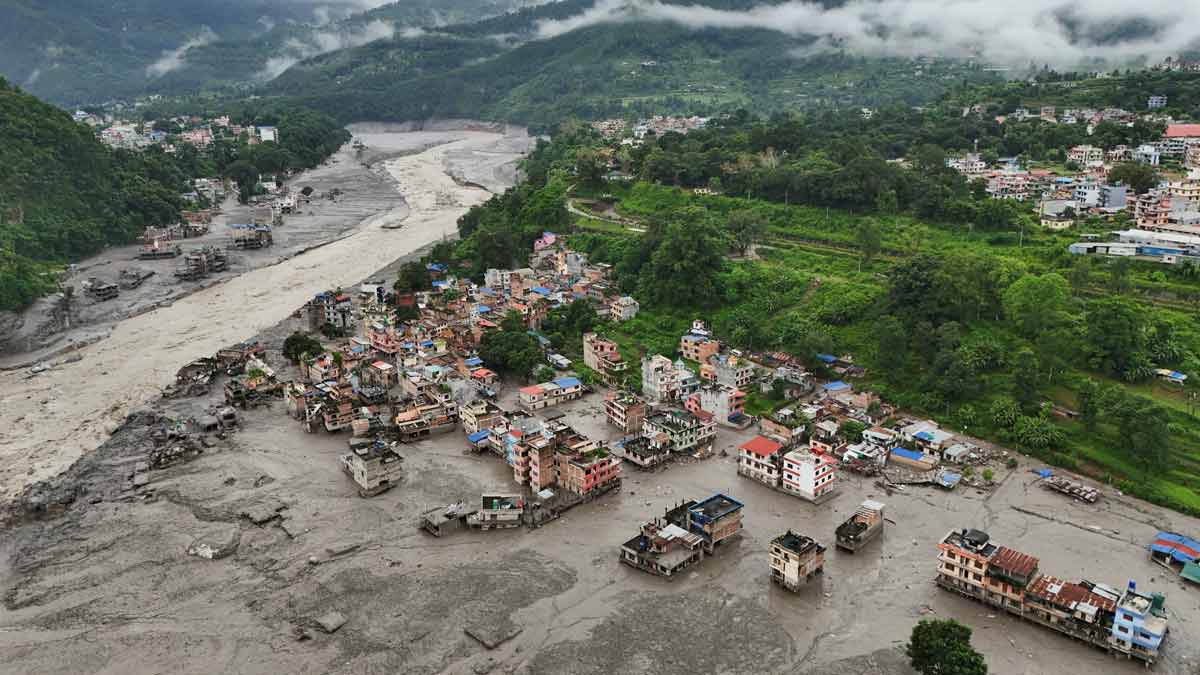
Geopolitical boundaries offer zero resistance to hydraulic energy. When a catastrophic flash flood originates in the high-altitude terrain of Tibet and breaches the border corridors of central Nepal, the resulting disaster operates on pure physical laws rather than administrative jurisdiction. Disasters of this magnitude demand structural decomposition rather than narrative recap.
The mechanics behind the event trace back to a compounding sequence: seismic activity in the Tibetan plateau triggering high-altitude rock and ice instabilities, which subsequently dammed and overwhelmed arterial waterways like the Bhote Koshi. When these temporary natural barriers fail, they release a high-velocity wave of kinetic debris. Understanding this systemic failure requires analyzing the vector mechanics, infrastructure vulnerability coefficients, and downstream propagation risks facing border states in India.
The Vector Mechanics of High-Altitude Outbursts
Standard flood forecasting relies on continuous precipitation metrics and predictable river-gauge increments. However, glacial and seismic-induced flash floods break these models. The initiating event—an earthquake or sudden ice-and-rock avalanche—acts as a point-source shock.
The primary variables governing the destructive capacity of the resulting torrent include:
- Gravitational Potential Energy: The steep descent from Himalayan heights to lower valley floors converts mass into extreme kinetic force over short spatial scales.
- Debris Load Concentration: Mud, boulders, and pulverized rock transform flowing water into a dense, high-viscosity mass capable of scouring bedrock and destroying reinforced concrete structures.
- Choke-Point Compression: Narrow gorges act as physical amplifiers, forcing a massive volume of water and sediment through constrained cross-sectional areas, spiking the wave height exponentially.
In the case of the Bhote Koshi and Trishuli corridors, these variables converged. Security footage from border sectors captured walls of slurry moving with enough velocity to sweep away multi-story concrete buildings and infrastructure foundations instantly. This confirms that traditional warning systems, which measure water level increments rather than upstream debris flow dynamics, face an inherent structural lag.
Infrastructure Vulnerability Coefficients and Asset Destruction
Critical infrastructure located along Himalayan river corridors operates under an under-estimated risk profile. Hydropower projects, bridges, and regional highways are routinely engineered to withstand standard 100-year flood discharge volumes. They are rarely engineered to survive a debris-laden hyper-concentration surge driven by upstream geotechnical failures.
The physical damage profile along the Nepal-Tibet border highlights three distinct failure modes within civil assets:
- Hydraulic Undermining: High-velocity flows scour riverbeds around bridge piers and retaining walls, causing structural collapse even when the superstructure remains intact.
- Impact Loading: Boulders weighing tens of tons act as kinetic battering rams against structural columns, compromising load-bearing capacities.
- Siltation and Turbine Choking: Operational hydropower facilities pulling water directly from glacial-fed rivers ingest massive sediment loads, destroying generation equipment and halting regional power output.
With multiple operational and under-construction hydropower projects damaged or destroyed, alongside dozens of kilometers of arterial roads severed, the economic recovery function shifts from simple repair to redesigning engineering resilience standards for high-risk seismic zones.
Downstream Propagation Risks and Cross-Border Alert Metrics
Water does not recognize international borders, a reality underscored when floodwaters transition from Nepal's mountainous terrain into the flat alluvial plains of Indian border states like Bihar and Uttar Pradesh. The primary channel routing this volume—the Gandak and Kosi river systems—acts as a long-distance conduit of kinetic and volumetric energy.
As the flood wave flattens and broadens across lowland geography, the immediate danger shifts from hyper-velocity impact to widespread inundation. Downstream administration centers face a compressed time-to-decision window. Because communication networks in upper Himalayan gorges are notoriously fragile and prone to immediate severance during a disaster, downstream authorities receive degraded telemetry.
High-alert statuses declared across northern Indian districts function as preventative circuit breakers. Yet, the efficacy of these alerts depends on localized evacuation protocols rather than macro-level warnings. When floodwaters travel up to 150 kilometers downstream—as evidenced by debris recovery points far from the initial breach—communities situated on ancient floodplains face severe exposure due to historical encroachment on natural drainage routes.
Deploy real-time satellite telemetry linked directly to automated upstream seismic and pressure sensors across high-risk Himalayan border zones, bypassing vulnerable terrestrial communication lines to secure automated early-warning feeds for downstream states.