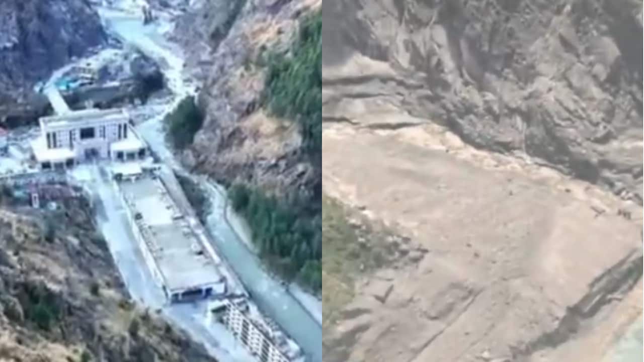
High-altitude trade corridors depend on fragile geomorphological stability that can disintegrate within minutes. When a catastrophic high-velocity debris flow struck the Nepal-Tibet border, it exposed the structural weaknesses inherent in Himalayan logistics nodes. Aerial imagery contrasting the standing architecture of Gyirong Port against meters of dense sludge offers a stark illustration of systemic vulnerability. Analyzing this event requires looking past superficial visual documentation to examine the mechanical drivers of flash floods, the cost function of geographic concentration, and the logistics bottlenecks created when critical international conduits fail.
The Mechanics of High-Altitude Debris Torrents
Understanding the devastation at Gyirong Port requires examining the initiating physics rather than treating the flood as a standard meteorological anomaly. The event originated from a massive structural failure of a high-altitude glacier within the Langtang national park region, registering as a magnitude 5.2 seismic event. Approximately 0.2 square kilometers of ice and rock sheared free, dropping vertically by more than a kilometer into the Lhende Khola riverbed.
This sudden displacement generated a multi-phase hydrodynamic shock wave:
- Kinetic Energy Conversion: The gravitational descent converted solid ice mass into an extraordinarily mobile debris flow.
- Volumetric Amplification: The mass scoured valley walls, entraining loose sediment, boulders, and water, causing river levels to surge by up to nine meters within thirty minutes.
- Hydraulic Pressure Concentration: Funneled through narrow mountain gorges, the slurry maintained high velocity until it struck international border infrastructure, rendering traditional flood defenses completely ineffective.
The transition from a localized glacial collapse to a transboundary catastrophe highlights a failure in regional early warning systems. Mountain watersheds lack real-time sensor arrays capable of measuring sub-surface ice destabilization or calculating debris-flow velocity vectors before impact.
The Economic Cost Function of Single-Node Dependency
Gyirong Port functions as the primary overland trade artery connecting Tibet and Nepal, facilitating billions in cross-border commerce, industrial exports, and electric vehicle transit. Designing this trade route through a narrow, river-adjacent mountain pass created an asymmetric risk profile.
The economic fallout operates on a severe penalty function:
- Infrastructure Paralysis: Dozens of bridges destroyed and nearly forty kilometers of arterial roadways damaged instantly isolate supply chains, freezing bilateral commerce.
- Capital Immobility: Commercial trucks, logistics hubs, and processing facilities trapped under more than one and a half meters of dense silt suffer immediate asset write-downs.
- Regional Ripple Effects: Downstream manufacturing and tourism sectors experience acute inventory starvation, escalating operational costs as alternative routing requires expensive air freight alternatives.
Relying on single-node corridors in active tectonic and cryospheric zones maximizes vulnerability. Economic efficiency models that prioritize low-cost proximity over structural resilience consistently fail when natural hazards reset the physical topography.
Logistics Bottlenecks and Cross-Border Mitigation Failures
Emergency response operations following the destruction of Gyirong Port reveal critical friction points in multi-agency disaster management. When physical infrastructure collapses, command and control structures face immediate degradation.
Communication lines and power grids on both sides of the border suffered simultaneous failure, preventing real-time damage assessments. Search and rescue teams faced severe deployment delays because heavy machinery could not access the site due to secondary road collapses and unstable mud slopes. Aviation assets, specifically military and civil transport helicopters, became the sole viable vector for evacuation, yet their payload capacity and weather dependencies restricted throughput during the critical golden hours of rescue operations.
Furthermore, international pilgrim and tourist tracking systems proved inadequate. With hundreds of foreign nationals unaccounted for across remote trekking routes, administrative bottlenecks emerged between local municipal police, national disaster authorities, and diplomatic missions attempting to reconcile missing persons registries.
Preventing future structural failures along trans-Himalayan trade routes requires a complete shift in infrastructure planning. Engineering protocols must transition from reactive post-disaster reconstruction to proactive topographical fortification, incorporating automated slope-stability radar, upstream sediment retention basins, and redundant multi-route supply architectures that eliminate single points of failure.
Gyirong Port Disaster Zone Looks Like Doomsday
This footage captures the scale of the debris flow and structural destruction at the Gyirong Port border crossing.


